Latest advances in sensor technology and data processing allow early detection, mapping and monitoring of crop infestation, helping prevent large-scale outbreaks.
A recent study published in Nature Scientific Reports, assesses the capability of very high-resolution satellite (VHRS) imagery and high-resolution unmanned aerial vehicles (UAVs) imagery for high-throughput phenotyping and detecting impacts of wheat rusts in earlier crop growth stages. UAVs and VHRS offer high potential for nonintrusive, extensive, rapid and flexible measurements of plant biophysical properties at very high spatial and temporal scales.
The study—led by CIMMYT in partnership with the Ethiopian Institute of Agricultural Research (EIAR) and Lincoln Agritech Ltd from New Zealand—establishes that these advanced sensor technologies are emerging as gamechangers in crop health management. They save time, complement traditional disease scoring methods and field surveys, and are cost-effective.
Further, the study establishes that multispectral VHRS sensors can pave the way for the upscaling of disease severity assessment from plot to regional scales at early growth stages.
Wheat rust is a global challenge
Globally, crop infections are an increasing threat to crop production and food security. Increased cross-border trade and travel, coupled with a changing climate are resulting in increased frequency and severity of crop disease outbreaks. Of all the diseases that affect wheat, wheat rusts are among the most damaging, capable of causing epidemics on a vast scale with significant economic and production losses. As of date, global losses from wheat rusts equate to 15 million tonnes per year (USD $2.9 billion). In Ethiopia, a major stripe/yellow-rust epidemic in 2010 affected an estimated 600,000 hectares, resulting in production losses of 15–20% and causing economic losses of USD $250 million. Similarly, a stem/black rust (SR) epidemic from 2013-2014 infected approximately 40,000 hectares. SR, which can cause 100% crop loss within weeks, is re-emerging as a major concern to wheat production.
Early detection, monitoring and timely intervention is key
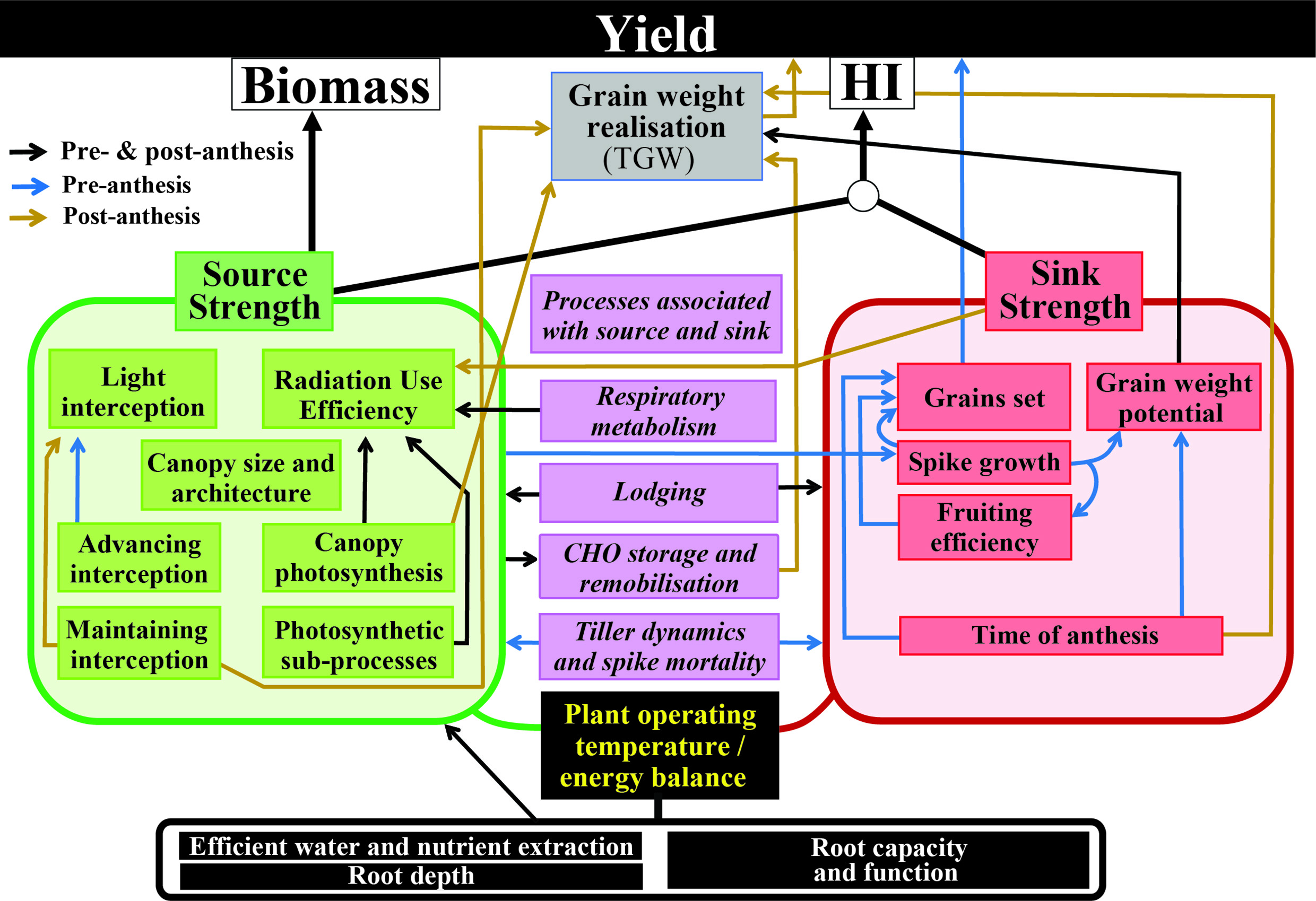
Rapid early-season detection, monitoring and timely control of wheat rusts in susceptible varieties are critical to avoid large-scale outbreaks, especially in countries where fungicides are scarcely available or too costly for smallholders. UAV-based high-throughput phenotyping (HTP) has been recently investigated to support wheat improvement breeding, in particular, to assess plant growth development, canopy architecture, physiology, reaction to abiotic stress, crop disease and insect pest response, and wheat yield.
Spectral and thermal measurements at the plant and canopy levels allow for monitoring the interactions between plant germplasm and environmental (abiotic and biotic) factors. The current study identifies several spectral features from UAV and VHRS multispectral imagery that have strong assessment power for the detection of combined wheat rust diseases at early crop growth stages.
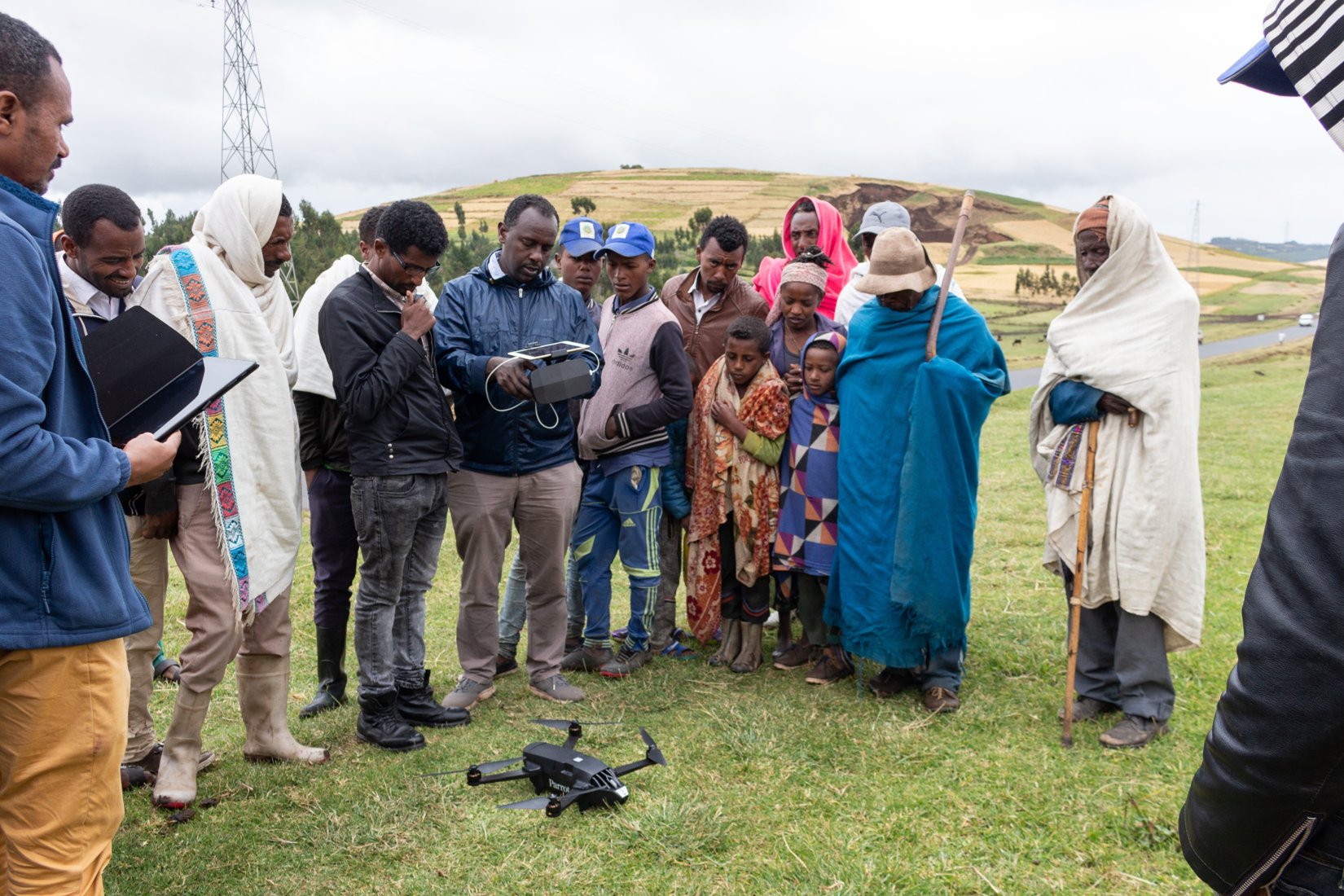
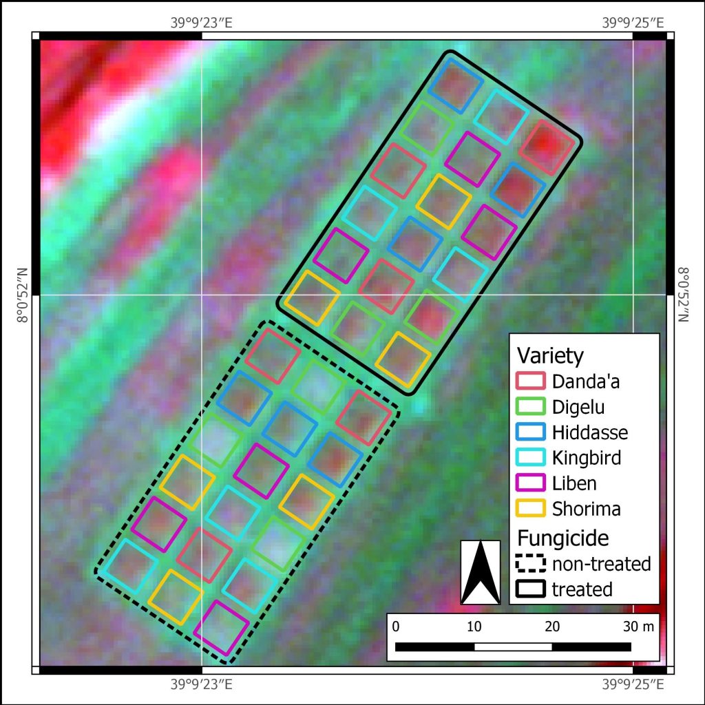
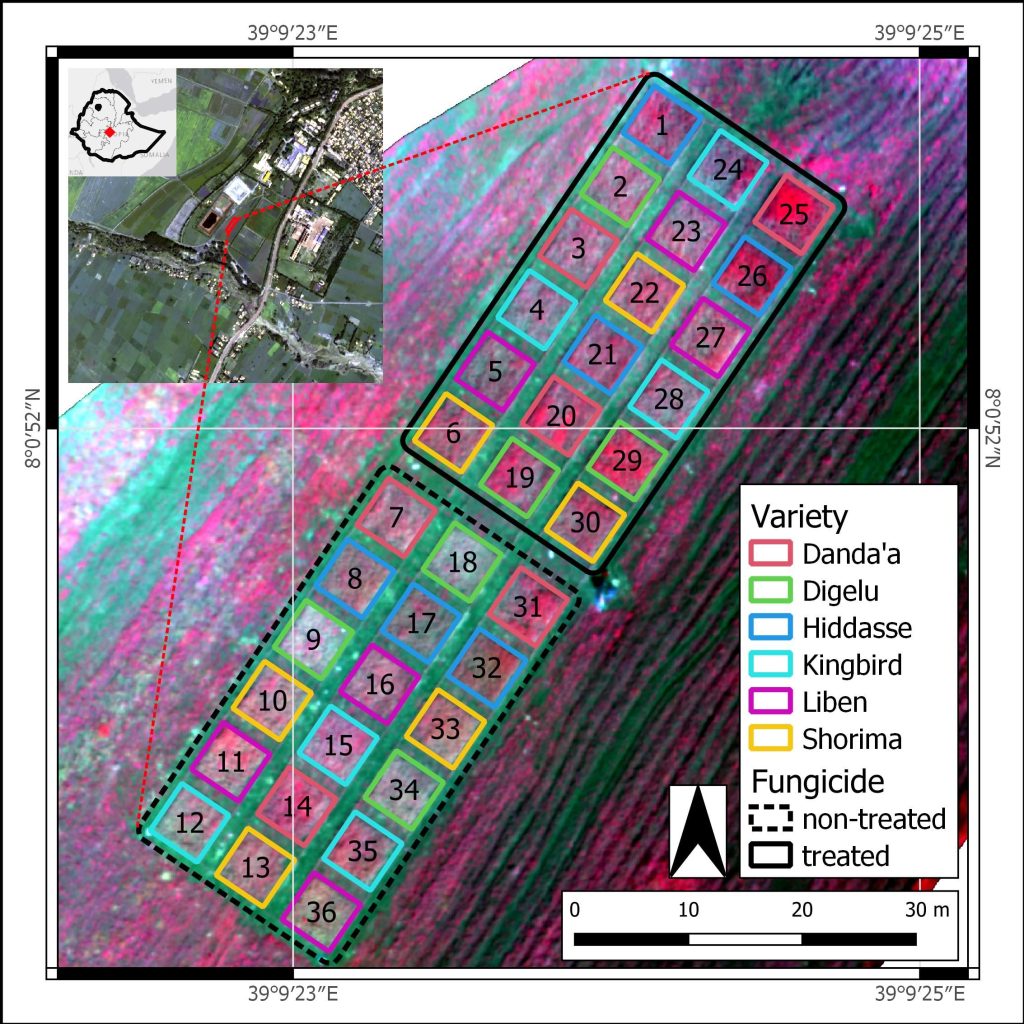
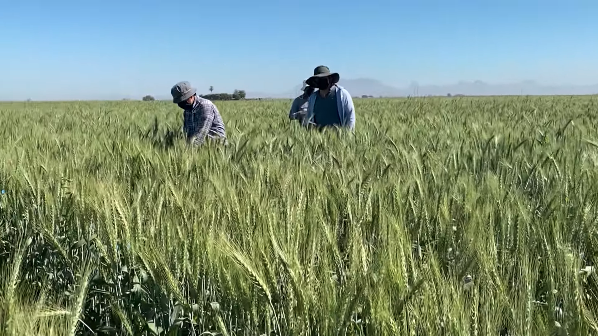
During a randomized trial conducted in Ethiopia, six bread wheat varieties with differing rust resistance were monitored using UAV and VHRS. In total, 18 spectral features were tested to assess stem and yellow rust disease progression and associated yield loss. Spectral properties of the wheat canopy (e.g., pigmentation, moisture, and biomass) are altered under rust disease stress. Using multispectral images and derived vegetation indices, it is possible to determine crop susceptibility to diseases and consequently can be used for detection and monitoring of wheat rusts.
Recent research on wheat, maize and dry bean demonstrated strong and significant correlations between vegetation indices extracted from UAV and VHRS imagery, confirming the feasibility of VHRS-HTP targeting biomass and yield; however, such satellite applications for plant breeding programs are still scarce.
Looking ahead to upscaling
This study provides valuable insight into the upscaling capability of multispectral sensors for disease detection from UAV imagery at 5 cm per pixel to pan-sharpened satellite imagery at 50 cm per pixel, demonstrating a first step towards upscaling disease detection from plot to regional scales. Further work will expand and improve current methodology to examine the VHRS detection capability towards machine and deep learning techniques (e.g., convolutional neural network) to allow for continuous monitoring systems, focusing on both single and mixed rust diseases under different treatments (e.g., variable fungicide rates, irrigation rates).
The early detection of diseases through spectral analysis and the integration of machine learning algorithms offers invaluable tools to mitigate the spread of infections and implement prompt disease management strategies.
Figures (1-2):
Field trial captured at varying spatial resolutions:
(a) SkySat false color composite (NIR-R-G) at 50 cm pixels (booting stage; 2020-10-17)
(b) UAV false color composite (NIR-R-G) at 5 cm pixels (heading stage; 2020-10-29)
(Photo: Nature Scientific Reports)
 Capacity development