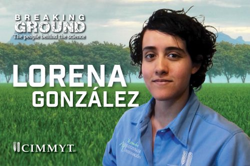
 Intrigued by the unique relationship our food crops have to their geographical environment, Lorena Gonzalez dedicated her passion for geomatic technology to collect site-specific farm data that is revolutionizing the way researchers and farmers tackle hunger.
Working with the International Maize and Wheat Improvement Center (CIMMYT) as a research assistant, Gonzalez is part of a seismic shift in agriculture, replacing time-consuming manual data collection with technology.
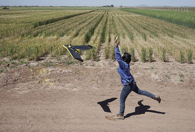
Instead of walking the fields taking measurements by hand, data is collected from a distance through remote sensing. Using cameras on board manned and unmanned aerial vehicles, as well as on ground sensors, Gonzalez gathers information such as plant height, canopy temperature and relative biomass, and evaluates plant health and soil spatial variability in minutes rather than weeks.
Collaborating with farmers and colleagues from maize and wheat breeding programs Gonzalez uses Geographical Information Systems (GIS) to organize and analyze data and patterns related to specific farm locations, making it easier to relate information to growers’ specific needs.
“It is important to make sure that data is properly geo-referenced, this way we know exactly how each crop is impacted by the matrix of factors in its environment,” said Gonzalez. “Collecting crop management and field data such as fertilization rates, irrigations schemes or soil properties provides us with information to understand and improve plant growth.”
The tailored information is used to improve farmers’ decision-making, allowing for more precise agriculture to create sustainable farming systems that produce more food with fewer resources, she said.
Gonzalez’ love for all things data saw her delve into the world of geospatial science studying her bachelor in Geomatics Engineering in the Mexican state of San Luis Potosi. Her passion for helping farmers achieve food security led her to apply for a job at CIMMYT. Since working with the Sustainable Intensification Program she has developed skills to collect and visualize agricultural data in meaningful ways to inform different stakeholders.
“Farmers, researchers and politicians can make better decisions when we streamline field data using available technology. The path of data from field to farm decision-makers can be streamlined using the available technology creatively and collaboratively, if we dare to build the appropriate systems.”
With climate change already affecting crop production, GIS becomes an increasingly important tool farmers can use to adapt and maintain crop yields, Gonzalez said. According to PNAS, each degree Celsius increase in global mean temperature is estimated to reduce the average global yields of wheat and maize by up to seven percent. These crops are key to the survival of humanity, providing a major portion of our caloric intake.
Remote sensing and precision agriculture plays a fundamental role in the ongoing challenge to reduce and cope with the effects of climate change and maximize land efficiency. Using quality data presented in useful ways helps farmers improve decision making, she added.
Gonzalez believes providing open access to geospatial decision support tools will allow smallholder famers to gain the information needed to make site-specific decisions on the exact quantity, location and timely application of resources needed to optimize food production.
If the world is to eliminate world hunger and malnutrition by 2030 as set out in the UN Sustainable Development Goals, smallholder farmers – who produce 80 percent of the world’s food – must benefit from access to remote sensing and precision agriculture, she said. Nine out of ten of the world’s 570 million farms are managed by families, making the family farm the predominant form of agriculture, and consequently a potentially crucial agent of change in achieving sustainable food security and in eradicating hunger in the future, according to UN reports.
Currently, Gonzalez is collecting data for an innovative private-public partnership, Mexico COMPASS, to help Mexican smallholder farmers increase wheat and sugar cane production by identifying factors that cause the yield gap between crop potential and actual performance.
The project aims to improve crop productivity and smallholder farmer incomes while facilitating rural community economic development. The data collected by Gonzalez in Mexico’s Yaqui Valley and in the state of Tabasco contributes to a system that combines earth observation satellite data with captured farm data to create a site-specific decision support tool for farmers. The project will help farmers to make better use of natural resources while monitoring crop health.
Improving smallholder farmer capacity and ability to make informed farming decisions is key to ending hunger and improving livelihoods, said Gonzalez.
Gonzalez’s work with CIMMYT’s Sustainable Intensification Program on the Mexico COMPASS project is funded by the UK Space Agency and has as partners: Rezatec, The University of Nottingham, Booker Tate and Colegio de Postgraduados (COLPOS).

 Innovations