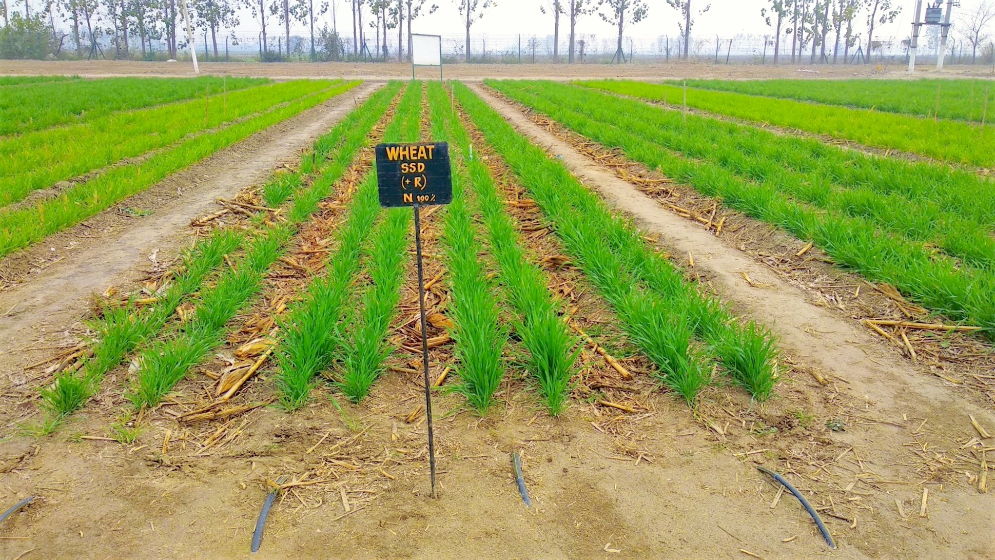
NEW DELHI (CIMMYT) — The new Soil Intelligence System (SIS) for India will help the states of Andhra Pradesh, Bihar and Odisha rationalize the costs of generating high-quality soil data and build accessible geospatial information systems based on advanced geostatistics. The SIS initiative will rely on prediction rather than direct measurements to develop comprehensive soil information at scale. The resulting data systems will embrace FAIR access principles — findable, accessible, interoperable, and reproducible — to support better decision-making in agriculture.
SIS is a $2.5 million investment funded by the Bill & Melinda Gates Foundation. This initiative is led by the International Maize and Wheat Improvement Center (CIMMYT), in collaboration with numerous partners including the International Food Policy Research Institute (IFPRI), World Soil Information (ISRIC), the Andhra Pradesh Space Applications Center (APSAC), and the state governments and state agriculture universities of Andhra Pradesh and Bihar. The initiative runs from September 2018 through February 2021.
“SIS will make important contributions towards leveraging soil information for decision-making in Indian agriculture by devising new soil health management recommendations,” explained Andrew McDonald, CIMMYT’s Regional Team Leader for Sustainable Intensification and Project Leader for the Cereal Systems Initiative for South Asia (CSISA). Researchers and scientists will combine mapping outputs with crop response and landscape reconnaissance data through machine-learning analytics to derive precise agronomy decisions at scale.
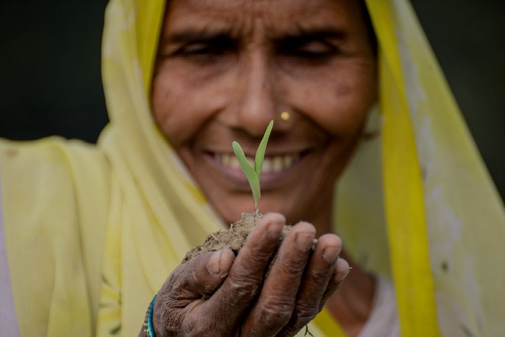
Farmers will be the primary beneficiaries of this initiative, as they will get more reliable soil health management recommendations to increase yields and profits. SIS will also be useful to state partners, extension and agricultural development institutions, the private sector and other stakeholders who rely on high-quality soil information. Through SIS, scientists and researchers will have an opportunity to receive training in modern soil analytics.
The SIS initiative aims to facilitate multi-institutional alliances for soil health management and the application of big data analytics to real-world problems. These alliances will be instrumental for initiating broader discussions at the state and national levels about the importance of robust data systems, data integration and the types of progressive access policies related to ‘agronomy at scale’ that can bring India closer to the Sustainable Development Goals.
Better soil analysis
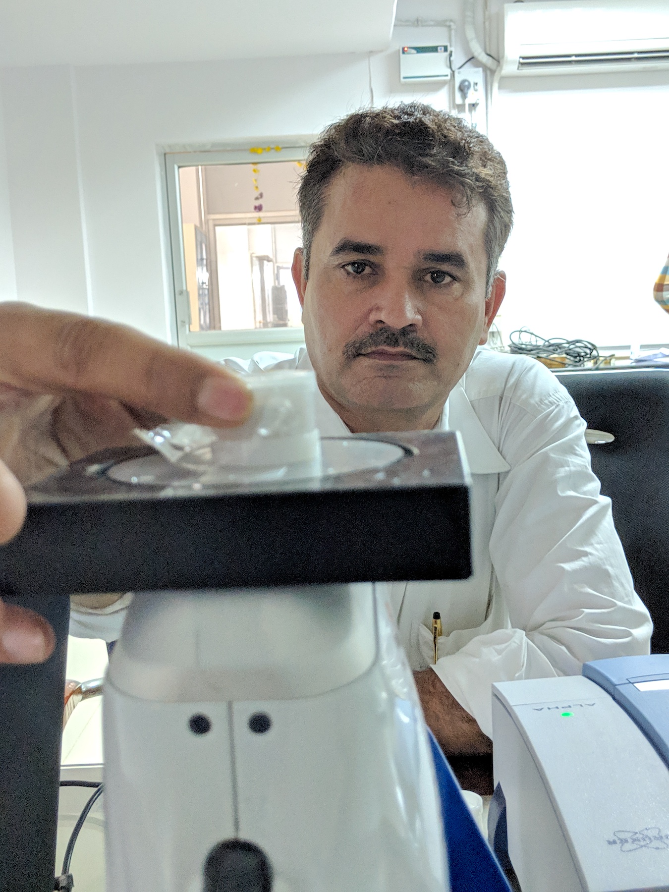
Spectroscopy enables precise soil analysis and can help scientists identify appropriate preventive and rehabilitative soil management interventions. The technology is also significantly faster and more cost-effective than wide-scale wet chemistry-based soil analysis.
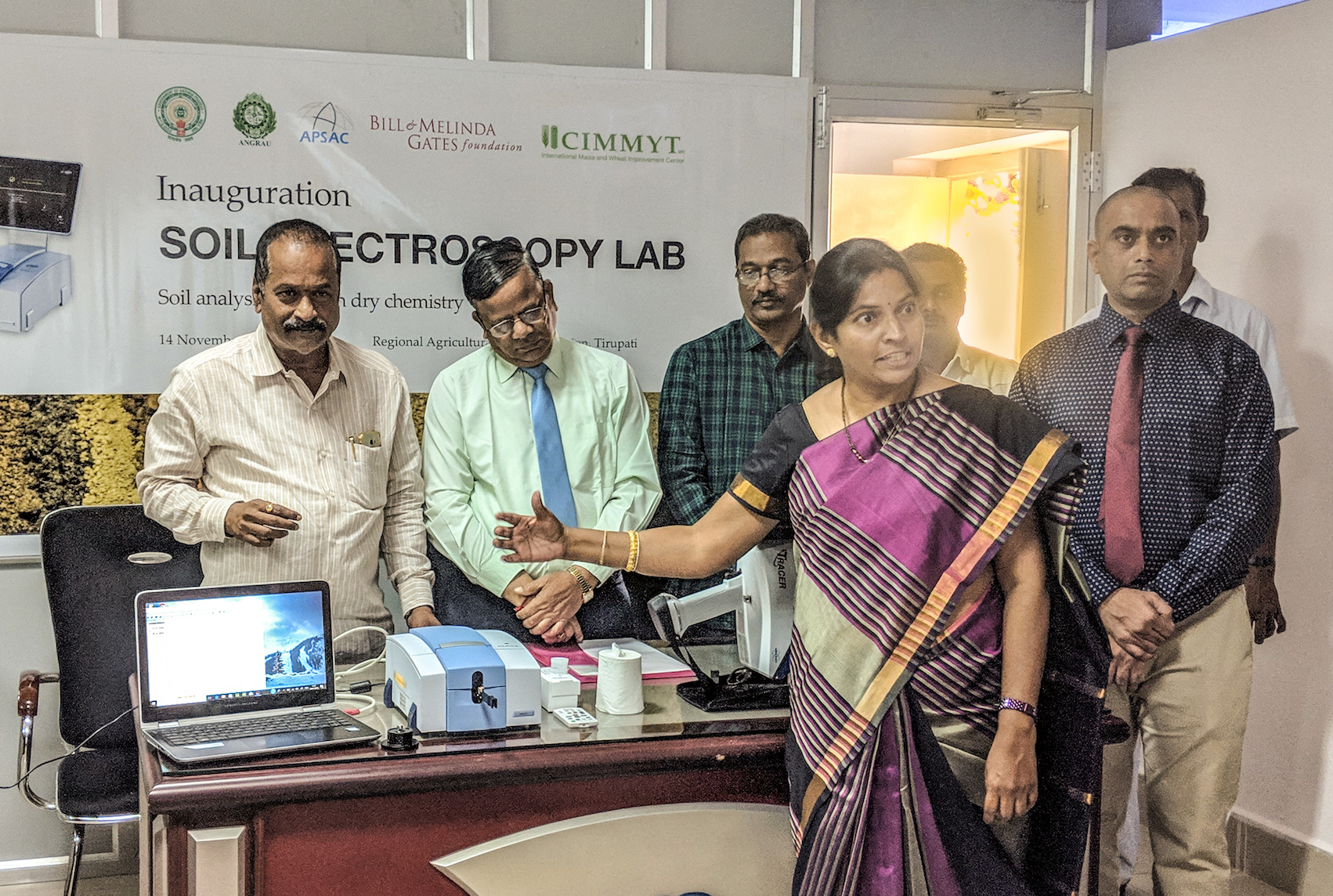
As part of the CSISA project, led by CIMMYT and funded by the Bill & Melinda Gates Foundation, two new soil spectroscopy labs were recently set up in Andhra Pradesh and Bihar, in collaboration with the state departments of agriculture. One lab is now operating at the Regional Agricultural Research Station (RARS) in Tirupati, Andhra Pradesh; and the other one at Bihar Agricultural University (BAU Sabour), in Bhagalpur, Bihar.
“The support from CIMMYT through the Gates Foundation will contribute directly to bringing down the cost of providing quality soil health data and agronomic advisory services to farmers in the long run,” said K.V. Naga Madhuri, Principal Scientist for Soil Science at Acharya N. G. Ranga Agricultural University. “We will also be able to generate precise digital soil maps for land use planning. The greatest advantage is to enable future applications like drones to use multi-spectral imagery and analyze rapidly large areas and discern changes in soil characteristics in a fast and reliable manner.”
Under the SIS initiative, soil spectroscopy results will be validated with existing gold standard wet chemistry methods. They will also be integrated with production practice data collected from the ground level, through new statistical tools.
Precise predictive models
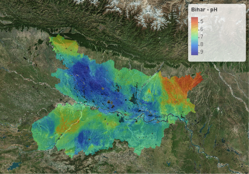
Drawing information from a limited number of soil observations from a sample dataset, digital soil mapping (DSM) uses (geo)statistical models to predict the soil type or property for locations where no samples have been taken.
“These ‘unsampled locations’ are typically arranged on a regular grid,” explained Balwinder Singh, CIMMYT scientist and Simulation Modeler, “so DSM produces gridded — raster — soil maps at a specific spatial resolution — grid cell or pixel size — with a spatial prediction made for each individual grid cell.”
“Adopting DSM methods, combined with intelligent sampling design, could reduce the strain on the soil testing system in terms of logistics, quality control and costs,” noted Amit Srivastava, a geospatial scientist at CIMMYT. “Improving digital soil mapping practices can also help create the infrastructure for a soil intelligence system that can drive decision-making at scale.”
In partnership with state government agencies and the Bill & Melinda Gates Foundation, CIMMYT will continue to support the expansion of digital soil mapping and soil analysis capacity in India. The CSISA project and the SIS initiative are helping to deliver soil fertility recommendations to farmers, an important step towards the sustainable intensification of agriculture in South Asia.
For more details, contact Balwinder Singh, Cropping System Simulation Modeler, CIMMYT at Balwinder.SINGH@cgiar.org.
 Gender equality, youth and social inclusion