remote sensing

Sieglinde Snapp
 Gender equality, youth and social inclusion
Sustainable Agrifood Systems Program Director (SAS)
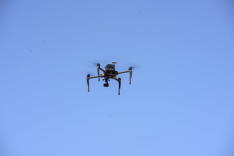
A view from above
Innovations
CIMMYT scientists use high-powered drones and space satellite imagery to accelerate crop improvement, fight pests and diseases and help farmers make better crop management decisions.
Crop-loss Assessment Monitor: A multi-model and multistage decision support system
Innovations
Study shows how the Crop-loss Assessment Monitor could help improve loss assessment and make crop insurance more efficient.
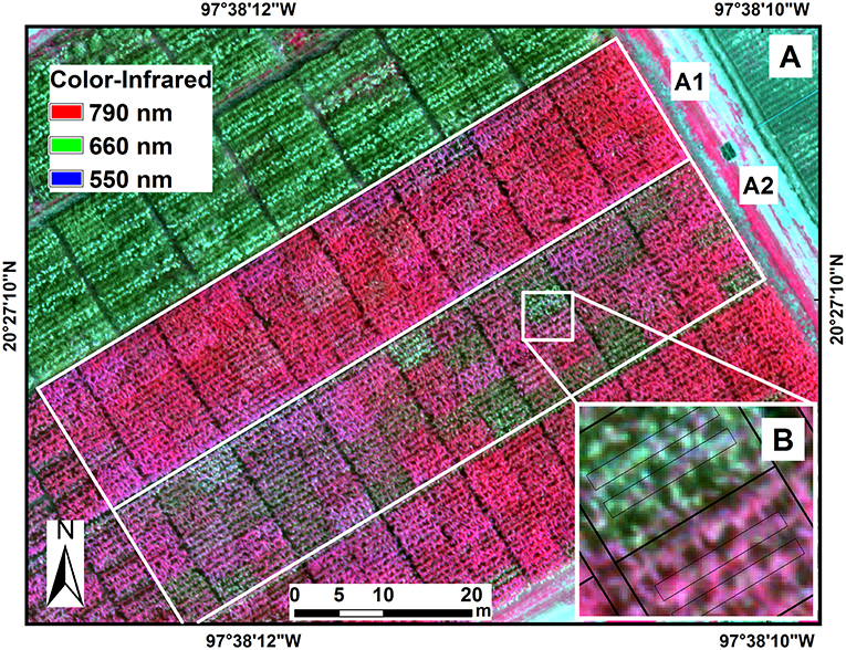
Bird’s-eye view
Innovations
Multispectral and thermal images taken by cameras on unmanned aerial vehicles are helping researchers to monitor the resistance of maize to tar spot complex and other foliar diseases.