EL BATAN, Mexico (CIMMYT) – The International Maize and Wheat Improvement Center (CIMMYT) has been selected by the European Space Agency (ESA) to have access to the pilot version of the Sen2-Agri processing system and receive training on its use.
As an ESA “champion user,” CIMMYT will test the ESA prototype system in Bangladesh and Mexico. These two sites cover a wide range of farming systems, from the large wheat fields of the Yaqui Valley to a more diverse system in Bangladesh, where parcel sizes can be as small as 0.05 hectares and farmers grow two to three crops per year on a single field.
“The great unmanned aerial vehicle (UAV) expertise acquired by CIMMYT is very complementary to the full exploitation of the new satellite generation capabilities,” says Pierre Defourny, professor at the Université catholique de Louvain in Belgium who is leading the Sen2-Agri project. “CIMMYT’s two cases will generate products that will support our joint efforts for wheat blast monitoring in Bangladesh and improve data availability for GreenSat in Mexico.”
In the early days of remote sensing, limited availability of data was a major constraint for putting the data to good use. Basic processing of the coarse data was also time consuming and tedious.
Fortunately, this has greatly changed in recent years. Open and free satellite data, such as Landsat 8 and Sentinel 1 & 2, allow for almost weekly coverages at resolutions as fine as 10 meters. Thanks to this new speed and precision, users can now focus on applying the data, deriving information products even for small holder farmers in remote areas.
For example, the CIMMYT-led STARS project in Bangladesh developed an irrigation scheduling app called PANI, which uses remotely sensed data to estimate crop water use. From this data the farmer receives a simple text message on their cell phone that gives recommendations as to whether a particular field needs to be irrigated or not.
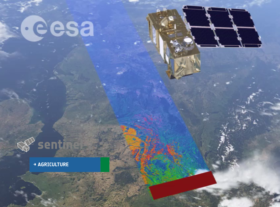
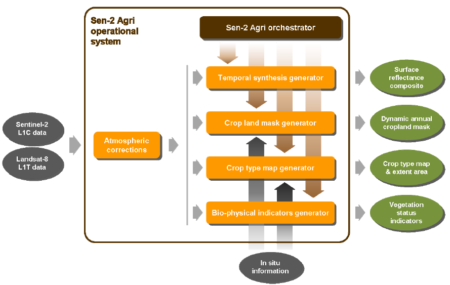
Sen2-Agri is unique compared to other systems in that it simplifies and automates satellite data processing. The system allows for semi-automated generation of products, such as cropland detection, crop classification, normalized difference vegetation index (NDVI) and leaf area index (LAI) based on images taken periodically by satellites Sentinel-2 and Landsat 8.
A signing ceremony was held on 15 August, 2016 to seal the cooperation between ESA and CIMMYT. Bruno Gérard, Director of CIMMYT’s Sustainable Intensification Program, sees this agreement as a fundamental game changer for CIMMYT’s geo-spatial work.
“Sen2-Agri will give CIMMYT access to high spatial and temporal resolution quality imagery and related ‘know-how,’ which in turn will enable us to further develop partnership with top-notch institutions in the earth observation field,” says Gérard.
The benefits of the Sen2-Agri are likely to far extend beyond the Yaqui Valley and Bangladesh. After the pilot phase of this project, the high-resolution imagery gathered could be applied to other areas CIMMYT projects are implemented.
In combination with bio-physical and socio-economic data, this will allow CIMMYT and other organizations to improve monitoring and evaluation, better assess and understand changes and shocks in crop-based farming systems and improve technology targeting across farmer communities.
The Sen2-Agri test program is being coordinated by Urs Schulthess. Please feel free to contact him at u.schulthess@cgiar.org if you have questions about or suggestions for future applications of the system.
 Innovations